
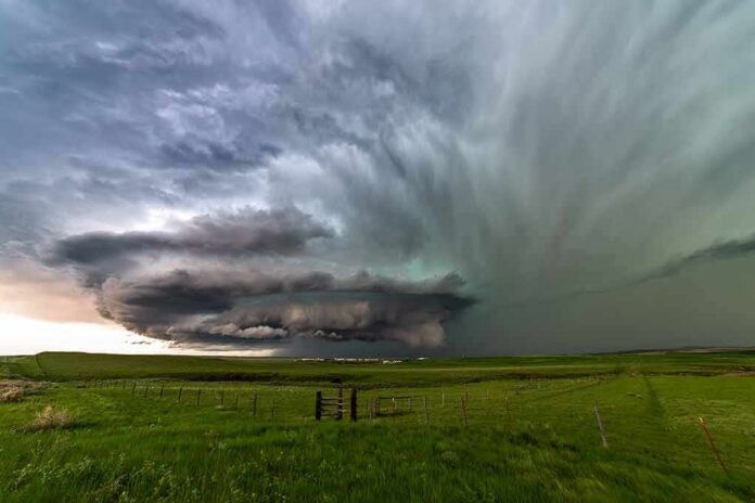
Three separate weather systems are crashing together over the middle of the country, and forecasters say the result is already flooding roads from Arizona to Chicago.
Story Snapshot
- Remnants of Hurricane Polo, moisture from Hurricane Rachel, and a separate storm system are merging into one “hybrid storm” over the central United States.
- The National Weather Service placed parts of the Central and Southern Plains under a Moderate Risk, the third-highest of four flood categories.
- Tens of millions of people were under flood advisories as of September 30, with evacuations ordered in New Mexico.
- Forecasters warn the heavy rain and flash flood threat will stretch across multiple days, hitting the I-35 corridor from Dallas-Fort Worth to San Antonio especially hard.
Three Storm Systems Collide Over the Plains
Forecasters say the remnants of Hurricane Polo are combining with fresh moisture from Hurricane Rachel and a separate sprawling storm system to form what meteorologists call a “hybrid storm.” This merged system is expected to bring days of heavy rain and considerable flooding across a huge stretch of the country, from Arizona through Texas and up toward Chicago over the next several days.
The threat is not theoretical. AccuWeather describes it as a “triple threat combination,” with leftover moisture from one hurricane, additional tropical moisture from a second, and a separate storm system all converging on the same stretch of the central and southern United States at once. That kind of layered moisture setup is what forecasters say is driving the unusually widespread and long-lasting flood risk.
Federal Forecasters Issue Moderate Risk Warning
The National Weather Service’s Weather Prediction Center placed parts of the Central and Southern Plains and the Corn Belt under a Moderate Risk of excessive rainfall, a Level 3 out of 4 on the agency’s scale, through Thursday morning. The Weather Prediction Center’s official guidance said impacts would keep coming through the overnight hours, stretching from the Southwestern United States across the southern Rockies and onto the adjacent central Plains.
Government forecasters specifically flagged the Interstate 35 corridor, running from Dallas-Fort Worth down to San Antonio, as an area that will remain under heavy rain threat. Separate Weather Service rainfall guidance tied the heaviest rain to a slow-moving cold front stalled over Kansas, northern Missouri, and western Illinois, where a lower-level Slight Risk also persists. These overlapping risk zones show how far the flood threat reaches beyond any single state.
Evacuations and Flood Advisories Already Underway
Tens of millions of people across the central United States were already under flood advisories on September 30 as Polo’s remnants and the other systems moved through, bringing heavy rain and the threat of dangerous flash floods, according to forecasters tracking the event. New Mexico saw flash flooding severe enough that officials ordered evacuations as Polo’s remnants entered the state, a sign of how fast the ground can turn dangerous once rain rates climb.
Climate reporting on the pattern points to the same mix of ingredients: tropical moisture from former Hurricane Polo, additional Pacific moisture tied to Hurricane Rachel, and humid Gulf of Mexico air all interacting with a stalled front over the central Plains. That combination is what meteorologists mean when they describe the system as a hybrid storm instead of a single weather event.
Why the Forecast Reads in Risk Categories, Not Certainty
The Weather Prediction Center’s rainfall outlooks are built as probability forecasts, estimating the chance that rain will exceed flash flood guidance within 25 miles of a given point, not guarantees of exact totals. The agency’s risk scale runs from Marginal up through Moderate and High, with each category tied to a specific probability threshold, which is why officials describe threats in levels rather than single predictions.
That probabilistic approach exists because flash flooding depends on local terrain, soil conditions, and how fast rain falls, not just total rainfall amounts over a wide area. Weather Service discussions have also noted that strengthening southerly flow ahead of a deepening low pressure system is drawing rich Gulf moisture northward into the Heartland, setting up several more rounds of storms across the north-central United States.
What Comes Next for Flood-Prone Regions
Forecasters expect the flash flood and heavy rainfall threat to keep shifting eastward, moving into the Midwest, Ohio Valley, and lower Great Lakes region through the coming days. Residents in those areas, along with the central Plains and Texas, face the highest odds of seeing rainfall totals heavy enough to overwhelm local drainage and trigger dangerous flash flooding, according to the latest government forecasts.
Sources:
zerohedge.com, weather.gov, mensjournal.com, noaa.gov, usatoday.com, forecast.weather.gov, accuweather.com, yaleclimateconnections.org, wpc.ncep.noaa.gov, journals.ametsoc.org