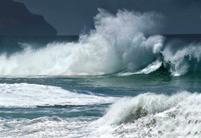
California’s coast faced 25–35 foot breakers with occasional 40–50 foot sets, forcing wide beach closures and flooding alerts.
Story Snapshot
- National Weather Service issued a High Surf Warning with 25–35 foot waves and larger sets.
- Monterey Peninsula agencies closed multiple beaches and turnouts through the weekend.
- Waves over 30 feet were reported at several points; favored spots saw even larger sets.
- Officials warned of rip currents, flooding at high tide, erosion, and injury risk.
What Officials Ordered And Why It Mattered
National Weather Service forecasters issued a High Surf Warning for Northern and Central California beaches through early Sunday. The alert called for breaking waves of 25 to 35 feet, with occasional sets of 40 to 50 feet at favored breakpoints. The agency warned that high tides could flood low areas, close roads, and speed up erosion. It also warned that strong rip currents and surging waves could sweep people into the ocean and cause serious injury or drowning.
Transportation and parks agencies on the Monterey Peninsula acted on the warning. Caltrans District 5 said local cities, counties, and state parks closed San Carlos Beach, McAbee Beach, Asilomar State Beach, and several Pebble Beach and Pacific Grove turnouts. Carmel River State Beach, Garrapata Beach, and Point Lobos State Natural Reserve were also closed. Agencies planned to keep closures in place from Friday evening through Sunday morning, with possible extensions if conditions stayed dangerous.
How Big The Waves Got Along The Coast
Reporters documented large waves at several points along the Bay Area and Central Coast. Offshore readings over 30 feet were reported near Monterey and Point Reyes, while breakers over 20 feet hit San Francisco and Half Moon Bay. At famous surf spots like Mavericks, favored breakpoints saw sets much larger than nearby beaches. Those local peaks matched the warning’s call for occasional 40 to 50 foot sets at specific locations.
Forecasters linked the hazard to a strong west and northwest swell moving into the region. They expected the swell to peak Saturday, with the largest breakers along west-facing beaches and reefs. The warning focused on breaking wave action in the surf zone, where run-up and rip currents pose the main risk to people and property. That focus explains why closures often target access points and low-lying areas near the waterline.
What This Means For Public Safety And Trust
Beach closures can feel disruptive, but the goal is simple: keep people away from sudden surges and rip currents during the peak. High Surf Warnings are built around the threat to life and property, not a promise of damage in every spot. That approach reflects how the ocean works. Conditions can vary a lot over short distances, and a favored reef can see much bigger sets than a nearby cove. Clear signs and simple rules help people make safer choices.
Record-breaking waves slammed the California coast Saturday, with offshore heights at Point Reyes reaching 31 feet, the second highest in nearly 30 years. The extreme surf flooded streets in Pacifica and pushed water hundreds of feet inland. Warnings remain in effect for the… pic.twitter.com/KnClf8nTXJ
— The Weather Channel (@weatherchannel) November 15, 2026
When warnings spread across different offices and time windows, the message can feel messy. People see huge waves in one town and calmer water in another and wonder whom to trust. The practical step is to check the local forecast office and posted closures before heading out. During this event, the alert language, the documented closures, and the size of the swell pointed the same way: stay off wet sand, avoid piers and rocks, and keep a wide buffer from the waterline.
Sources:
nytimes.com, forecast.weather.gov, usairnet.com, marine.weather.gov